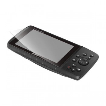
Parim abiline maastikul, teel ja veepeal navigeerimiseks on Garmin GPSmap 276Cx.
Tugev ja vastupidav GPSmap 276CX on vääriline järglane legendaarsele mudelile GPSmap 276C.

Uus GPSmap 276Cx on edasi arendatud legendaarsest mudelist GPSmap 276C.See oli tuntud Garmini kõigi aegade kõige universaalsema mudelina, mida paljud jäid taga igatsema oma vastupidavuse ja tolle aja kohta eriti selge ekraani pärast. Garmin soovis säilitada algse kasutusmugavuse.Kogemaks "vana kooli" headust kasutatakse uuel seadmel 276Cx täpselt sama klahvistikku kui eelkäijal. Üllatame uusi 276 kasutajaid mugava ja loogilise kasutajaliidesega ning rohkete lisavõimalustega.
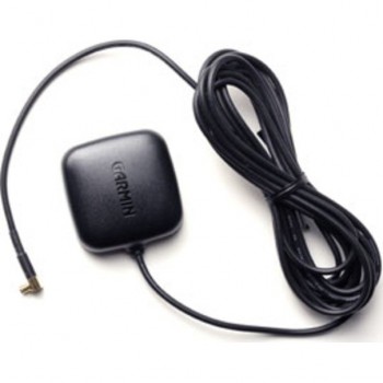
Uuendatud GPS- ja GLONASS- andurid lisavad kiirust ja täpsust rasketes tingimustes. Võid parandada asukoha täpsust, lisades seadmele MCX pistikuga välisantenni (lisavarustus).Seda eeskätt metallist roolimajas või soomukis.Uus baromeetriline kõrgusmõõtja annab täpsema asukoha ja elektrooniline kolmeteljeline kompass näitab õiget suunda kõikides oludes,ka paigal seistes.
GPSMAP 276Cx gets a comprehensive refresh on sensor technology. The device features GPS and GLONASS positioning for better performance in challenging environments; to get optimal satellite tracking in vehicle interiors add an external antenna (not included) to the built-in MCX connector. To improve situational awareness it now also has a barometric altimeter to get you smooth elevation readings and an electronic 3-axis compass to give you the right bearing under any condition – even when standing still.
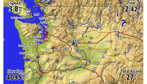
We know how critical optimum readability is during navigation therefore we created the new GPSMAP 276Cx with a large 5" outdoor-readable display with rich colour support for better mapping display. Due to its great viewing angle it can be clearly seen from various positions. So even mounted in a cockpit, the clear visibility and button-based interface allows for safe operation even in a shaky environment, like a boat or off-road vehicle.
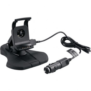
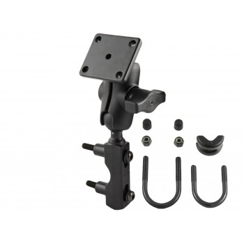
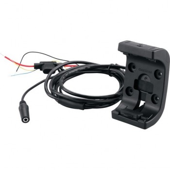
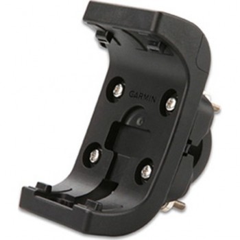
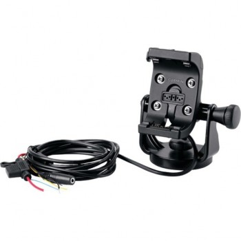
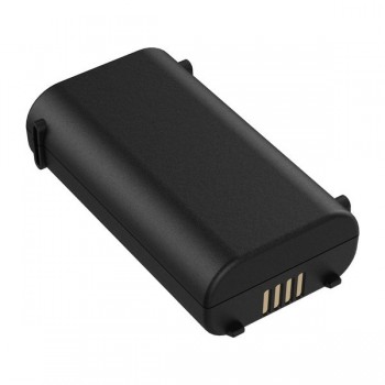
Built to Garmin’s high standards this device performs under almost any conditions. It is highly durable and water rated to IPX71 thanks to a thoroughly tested tough mounting system. With more than 4 years of experience working with the Montana®, we can provide solid mounts to put on almost any vehicle or vessel out there. To provide you with even more freedom we made the device more flexible when it comes to power supply – you can either hook the device up to the power supply of your vehicle or boat or use the NiNH power pack (up to 17h of battery life) or 3 optional AA batteries (up to 9h of battery life).

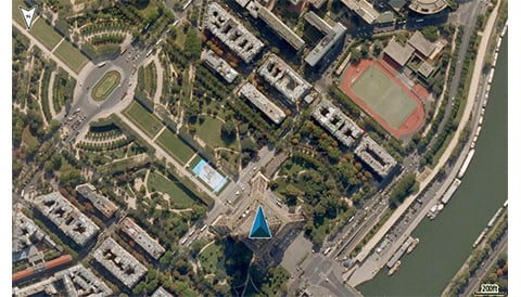
Almost anywhere you want to go, GPSMAP 276Cx has a compatible map to take you there. It comes with a large 8GB internal memory preloaded with a worldwide basemap, a Recreational Map of Europe and includes a free 1-year BirdsEye Satellite Imagery subscription. It also supports a variety of optional mapping, likeBlueChart® g2 HD marine charts, Garmin TOPO and TOPO PRO maps, City Navigator® NT, Garmin Custom Maps and BirdsEye Select raster maps. A microSD™ slot allows you to expand the memory further to load additional mapping on it.
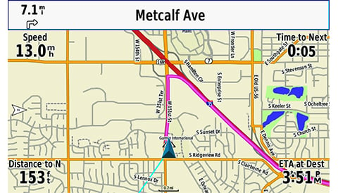
Together with appropriate mapping GPSMAP 276Cx offers additional navigation features such as the well-known Drive-mode for on street navigation or Curvy Road routing for motor bike riders, that highlights smaller and more fun roads to ride. Used together with TOPO PRO maps, the device can select from a number of recreational routing options that choose appropriate road classes for each activity or vehicle. And for people that prefer navigation on courses and tracks the new 276Cx also provides advanced track navigation.
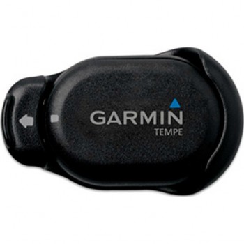
The new GPSMAP 276Cx also comes with a number of advanced connected features. You can connect your 276Cx via a Bluetooth headset to get TTS guidance in your helmet. Or once connected to a smartphone2, you can receive Active Weather3 that provides weather forecast and animated Weather Radar view on your mapping screen, smart notifications like mails, SMS or social media updates or LiveTrack that allows you to share your exact location with family and friends. The device can also wirelessly connect to external sensors via ANT+ like tempe™ for external temperature readings, or you can connect it to WiFi for over-the-air updates and Garmin Connect™ database syncs.
1See Water Rating
2When paired with a compatible smartphone
3Active Weather is available in the UK, Ireland, Portugal, Spain, France, Germany, Belgium, Netherlands, Luxembourg, Switzerland, Denmark, Norway, Sweden, Finland, Austria and Slovenia with partial coverage in Northern Italy.
Physical & Performance |
|
| Physical dimensions | 191.5 x 94.5 x 44.0 mm |
|---|---|
| Display size, WxH | 127.0 mm (5.0") diagonal |
| Display resolution, WxH | 800 x 480 pixels |
| Display type | Bright, sunlight readable WVGA display |
| Weight | 450 g with included rechargeable pack; 415 g with AA batteries (not included) |
| Battery | Rechargeable lithium-ion (included) or 3 AA batteries (not included); NiMH or Lithium recommended |
| Battery life | Up to 16 hours (lithium-ion); up to 8 hours (AA batteries) |
| Water rating | IPX7 |
| High-sensitivity receiver | |
| Interface | high-speed USB and NMEA 0183 compatible |
| Camera |
No |
| Barometric altimeter | |
| Electronic compass | Yes (tilt-compensated 3-axis) |
| Unit-to-unit transfer (shares data wirelessly with similar units) | |
Maps & Memory |
|
| Basemap | |
|---|---|
| Preloaded maps |
Preloaded Recreational Map of Europe & BirdsEye Satellite Imagery download |
| Ability to add maps | |
| Built-in memory | 8 GB (3.2 GB available to use) |
| Accepts data cards | microSD card (not included) |
| Custom POIs (ability to add additional points of interest) | |
| Waypoints/favorites/locations | 10000 |
| Routes | 250 |
| Track log | 20,000 points, 250 saved tracks |
Outdoor Features |
|
| Automatic routing (turn by turn routing on roads) | Yes (with optional mapping for detailed roads) |
|---|---|
| Custom maps compatible | |
| Hunt/fish calendar | |
| Sun and moon information | |
| Tide tables | Yes (with optional Bluechart) |
Garmin Connect |
|
| Garmin Connect compatible (online community where you analyze, categorize and share data) | |
|---|---|
Additional |
|
| Additional |
|
|---|---|